

mega fauna logging
research priority 3
Investigating the physical, chemical, and biological characteristics of the water column for better understanding.
At SBMA, we’re working to better understand what lives in our deep ocean — especially on our deep seabed.
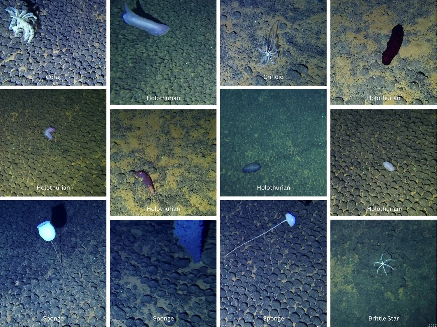
Through licensed exploration and marine research, we’re using underwater video and sampling to document marine species particularly from the megafauna group (species larger than 2 cm).
This is important because:
It helps us know what’s out there before any activity happens
We can identify areas that may require protection or conservation
It ensures our decisions are based on real data, not assumptions
By building this kind of deep-sea knowledge, we’re making sure that Cook Islands marine life — even the ones we don’t often see — are respected and considered in how we manage our ocean space.
Megafauna logging from different parts of the Cook Islands - below are from the Underwater Minerals Conference 2024

Abyssal Pacific Seafloor Megafauna Atlas (APSMA)
The Abyssal Pacific Seafloor Megafauna Atlas (APSMA) is a scientific database that catalogues deep-sea megafauna—large invertebrates and fish living on the seafloor—across the Pacific Ocean. Developed through extensive seabed imaging (from Clarion Clippeton Zone and Central, Eastern Kiribati), APSMA provides standardized taxonomic references to support research, monitoring, and environmental management in the deep sea.
SBMA uses APSMA as the basis for recording and identifying megafauna observed during surveys. More user-friendly versions of the catalogue have been created for reference and awareness purposes. Users hope to expand the catalogue with examples from other areas, including the Cook Islands as research continues.
one-pager version of catalogue (active links to/from table of contents)
two-pager version of catalogue (compressed, no links)
word doc of catalogue (structured) available on request
APSMA was developed by Erik Simon-Lledó, Amon, Diva J., Guadalupe Bribiesca‐Contreras, Daphne Cuvelier, Jennifer M. Durden, Sofia P. Ramalho, Katja Uhlenkott, Pedro Martinez Arbizu, Noëlie Benoist, Jonathan Copley, Thomas G. Dahlgren, Adrian G. Glover, Bethany Fleming, Tammy Horton, Se-Jong Ju, Alejandra Mejia-Saenz, Kirsty McQuaid, Ellen Pape,mChailinn Park, Craig R. Smith, Daniel O. B. Jones, (2023). Abyssal Pacific Seafloor Megafauna Atlas (APSMA), Version 1.0. Zenodo.
seabed geoforms and subtrates atlas in the cook islands (gsaci)
The Seabed Geoforms and Substrates Atlas of the Cook Islands (GSACI) is a reference atlas developed to support the classification and characterisation of seabed habitats in the Cook Islands. Based on the Coastal and Marine Ecological Classification Standard (CMECS), it provides examples of seabed geoforms and substrates observed during scientific research cruises in Cook Islands waters.
The GSACI provides a common reference for researchers, government agencies and other stakeholders working with seabed imagery and environmental data. The classification of geoforms and substrates, alongside observations of megafauna and depth, can help support the identification and mapping of habitat types and contribute to environmental assessment and responsible seabed management in the Cook Islands.
GSACI was developed by Dr. John Parianos and Chloe-Ane Wragg.
Go back to: research initiatives > research priorites